I. Storm evolution
- Currently (December 17), a storm with the international name JELAWAT is active in the southeastern sea of the Southern Philippines. At 13:00, the storm's center was at about 7.8 degrees North latitude; 128.6 degrees East Longitude, on the southeastern sea of the Southern Philippines. The strongest wind near the center of the storm is level 8 (62-74km/h), gusting to level 10, moving west, about 20km/h.
- Early on the morning of December 18, after entering the eastern mainland of the Southern Philippines, storm JELAWAT weakened into a tropical depression.
- On the morning of December 20, the tropical depression crossed the southern area of PaLa-Oan Island (Philippines), entering the East Sea.
- On the afternoon of December 21, after entering the southwest sea of Truong Sa archipelago, the tropical depression weakened into a low pressure area. At 13:00, the center of the low pressure area was at about 7.5 degrees North latitude; 111.5 degrees East Longitude, in the southwest area of Truong Sa archipelago. The strongest wind in the center of the low pressure area decreased to below level 6 (below 39km/h).
II. Direction and response work
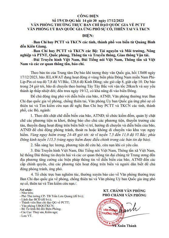
- On December 17, 2023, the Standing Office of the National Steering Committee for Natural Disaster Prevention and Control issued dispatch No. 19/CD-QG to ministries and provinces/cities in the coastal area from Quang Binh to Quang Binh. Kien Giang on proactively responding to the storm near the East Sea (storm JELAWAT).
