Trung tâm phòng tránh và giảm nhẹ thiên tai

Trung tâm Chính sáchvà Kỹ thuật phòng chống thiên tai

Giao diện dễ tiếp cận vietnam english
Đăng nhập

Quản lý - Hợp tác - Cùng hành động

  • Trang chủ
  • Giới thiệu
    • Giới thiệu
    • Cơ cấu tổ chức
    • Chức năng - nhiệm vụ
    • Chiến lược phát triển
  • Tin tức
    • Tin Trong nước - Quốc tế
    • Bản tin Trung tâm
  • Trung tâm Thông tin
    • Sự kiện thiên tai
    • Kiến thức cơ bản
    • Cơ sở dữ liệu
      • Chính sách và Kỹ thuật PCTT
      • CSDL Ngân hàng cát ĐBSCL
      • CSDL Dân sinh kinh tế
      • CSDL Viễn thám
      • Thiệt hại và nhu cầu
      • Đề án nâng cao nhận thức CĐ
        • Ma trận dự án
        • Mạng lưới hỗ trợ kỹ thuật
        • Tài liệu Đề án 1002
          • Văn bản pháp quy
          • Tài liệu tham khảo
          • Tài liệu truyền thông
        • Theo dõi & đánh giá
        • Đánh giá RRTT-DVCĐ
          • Bản đồ RRTT-DVCĐ
          • Bản đồ khác
          • Báo cáo đánh giá
        • Kế hoạch phòng chống thiên tai
      • Hệ thống giám sát thiên tai
      • Hệ thống giám sát camera
      • CSDL không gian
    • Thư viện ảnh
    • Dự án Nông thôn mới
      • Cổng thông tin điện tử
      • Sản phẩm dự án Nông thôn mới
    • Công khai ngân sách nhà nước
  • Đối tác
  • Dự án
  • Lịch công tác
  1. Tin tức
  2. Trang tin chi tiết
  • Share this on Facebook
  • Share this on Twitter
  • Share this on GooglePlus

Cao Bang: The first rains of the season cause flooding and landslides in many areas.

8:40:58, 29/06/2026 Heavy rains caused the Bang River to rise rapidly, prompting two hydroelectric power plants to issue urgent flood release notices.

Cơn mưa đầu mùa khiến nhiều nơi ở Cao Bằng ngập lụt, sạt lở
Heavy rains are causing flooding and landslides in many areas of Cao Bang province.

According to information from specialized agencies, due to heavy rain, from 7:00 AM to 8:00 AM on June 26th, the water level of the Bang River increased at a rate of approximately 95 cm/hour.

At the Bang Giang Hydrological Station at 8:00 AM, the measured water level was 179.91m, about 0.59m lower than alarm level 1, but it was rapidly rising.

Given this situation, residents in the hamlets of Ma Quan, Na Teng, Thai Cuong, Thanh Hung, and Ban Don (Hoa An commune) were advised to proactively move their property, livestock, and vehicles to higher, safer places; and to constantly monitor weather developments and water levels.

They were also advised to avoid areas with deep flooding and strong currents, and to remind children not to play near rivers and streams to prevent accidents.

On the same day, the Tien Thanh Hydropower Plant (Hanh Phuc commune) issued an urgent notice regarding flood release due to heavy rain in the catchment area and water flowing from upstream into the reservoir.
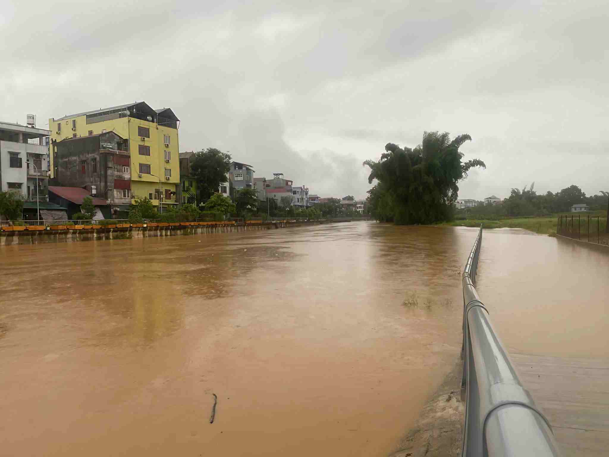
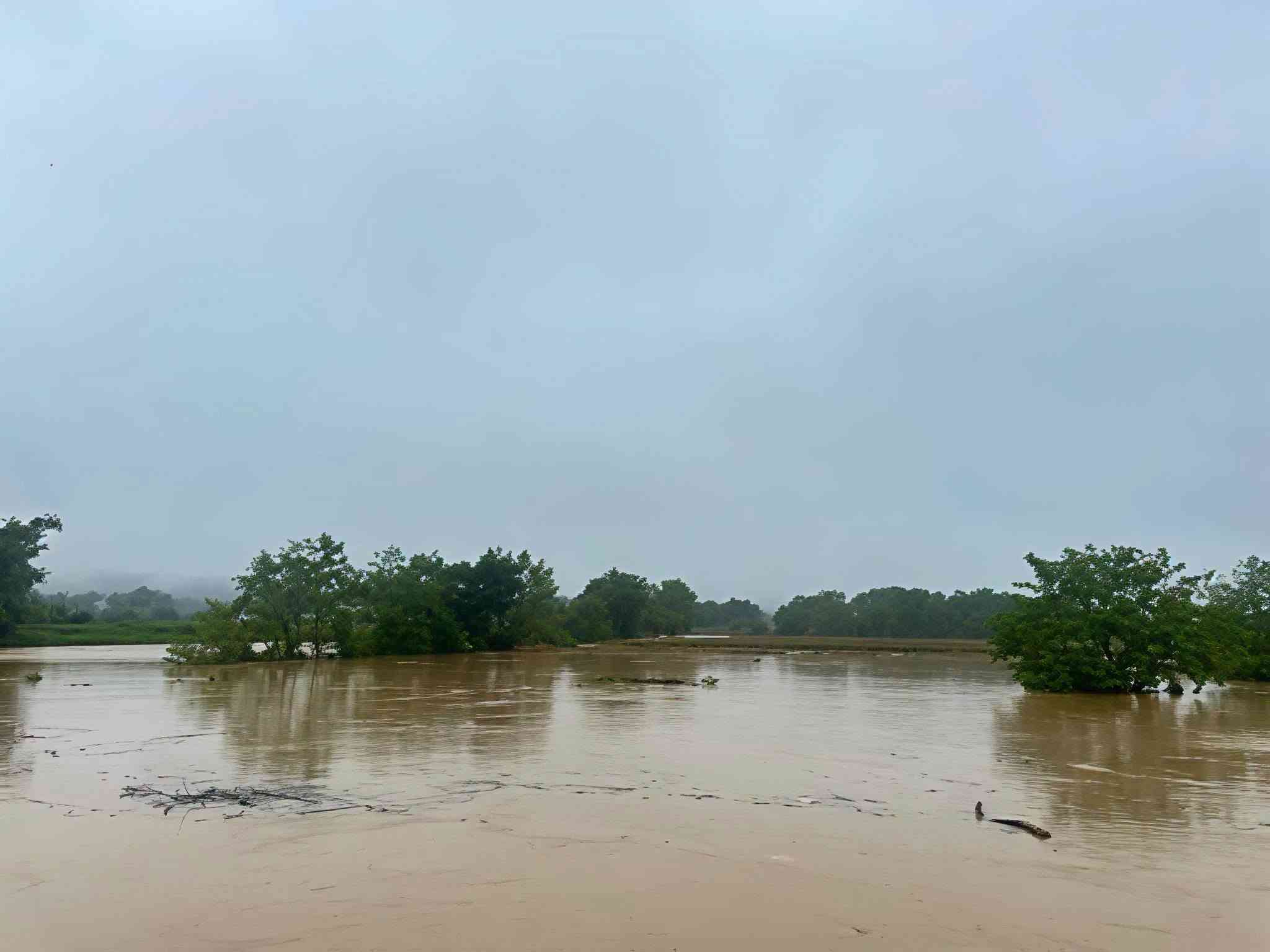
Lũ gây ngập diện rộng tại khu vực ven sông. Ảnh: Xã Hòa An
Flooding caused widespread inundation in the riverside area. 

According to the announcement, at 9:30 AM on June 26th, the inflow into the reservoir reached 260 m³/s, with the water level at 157.4 m. It is predicted that the inflow will continue to increase to 500 m³/s by 10:00 AM.

The power plant began regulating the water flow from 10:00 AM on the same day with a total discharge of 500 m³/s, including 243.22 m³/s through the spillway and 256.78 m³/s through the turbines.

The unit predicts that the water level in the downstream area may rise by approximately 0.5 m, affecting some areas in the communes of Hanh Phuc, Thach An, Phuc Hoa, and Hoa Thuan.

The power plant requests that local authorities widely inform the public to avoid going to the riverbanks during the flood discharge and to proactively implement disaster prevention and control measures.
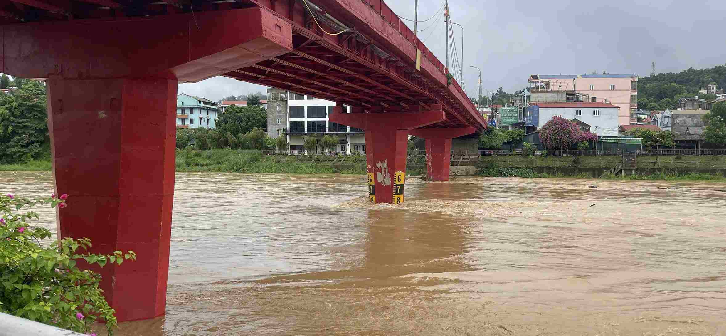
Biên độ lũ trên các sông đang lên rất nhanh. Ảnh: Phường Thục Phán
Flood levels on the rivers are rising very rapidly.

Meanwhile, the Binh Long Hydropower Plant also issued an urgent notice regarding reservoir regulation due to heavy rainfall in the catchment area.

According to the plan, the plant began releasing water at 4:00 AM on June 26th to maintain the reservoir water level at 209.8m. At 4:00 AM, the inflow into the reservoir was approximately 100 m³/s, forecast to increase to 200 m³/s by 5:00 AM. The total discharge reached 130.18 m³/s, including 90.76 m³/s through the spillway and 41.09 m³/s through the turbines.

The regulation is predicted to cause the water level in Pac Gay hamlet, Hoa An commune to rise by about 0.6m. Water will reach this area almost immediately after the release and, about 30 minutes later, will merge into the Bang Giang River at the head of the bridge in Hong Viet commune (formerly).
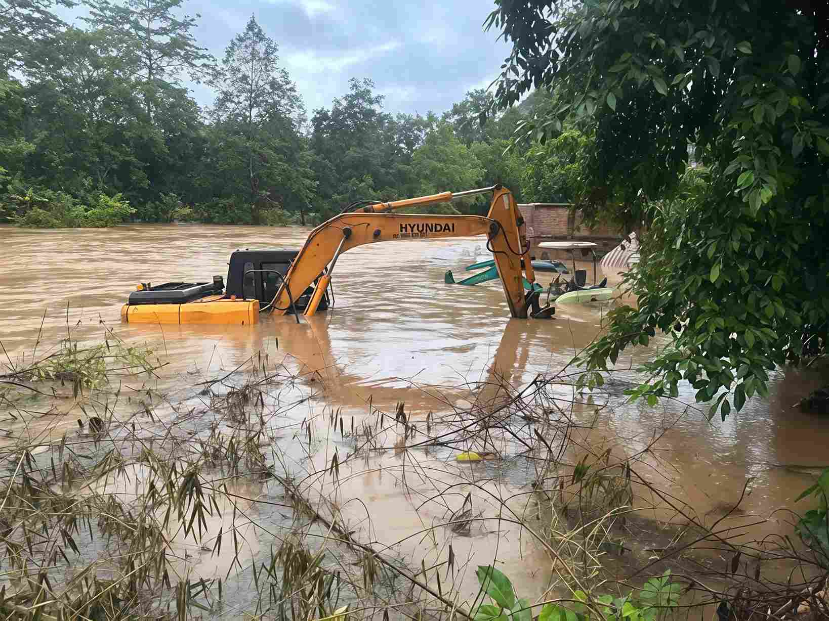
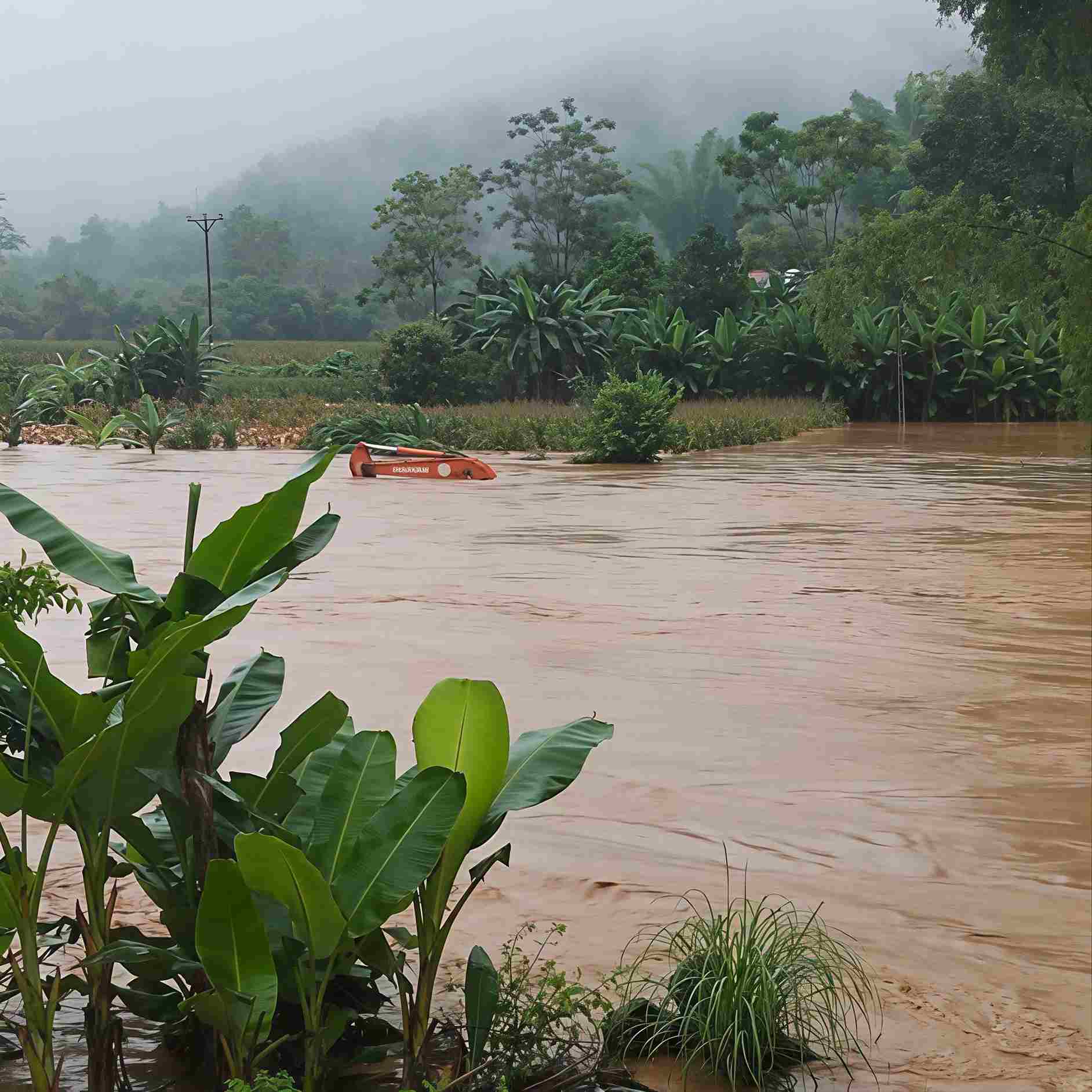
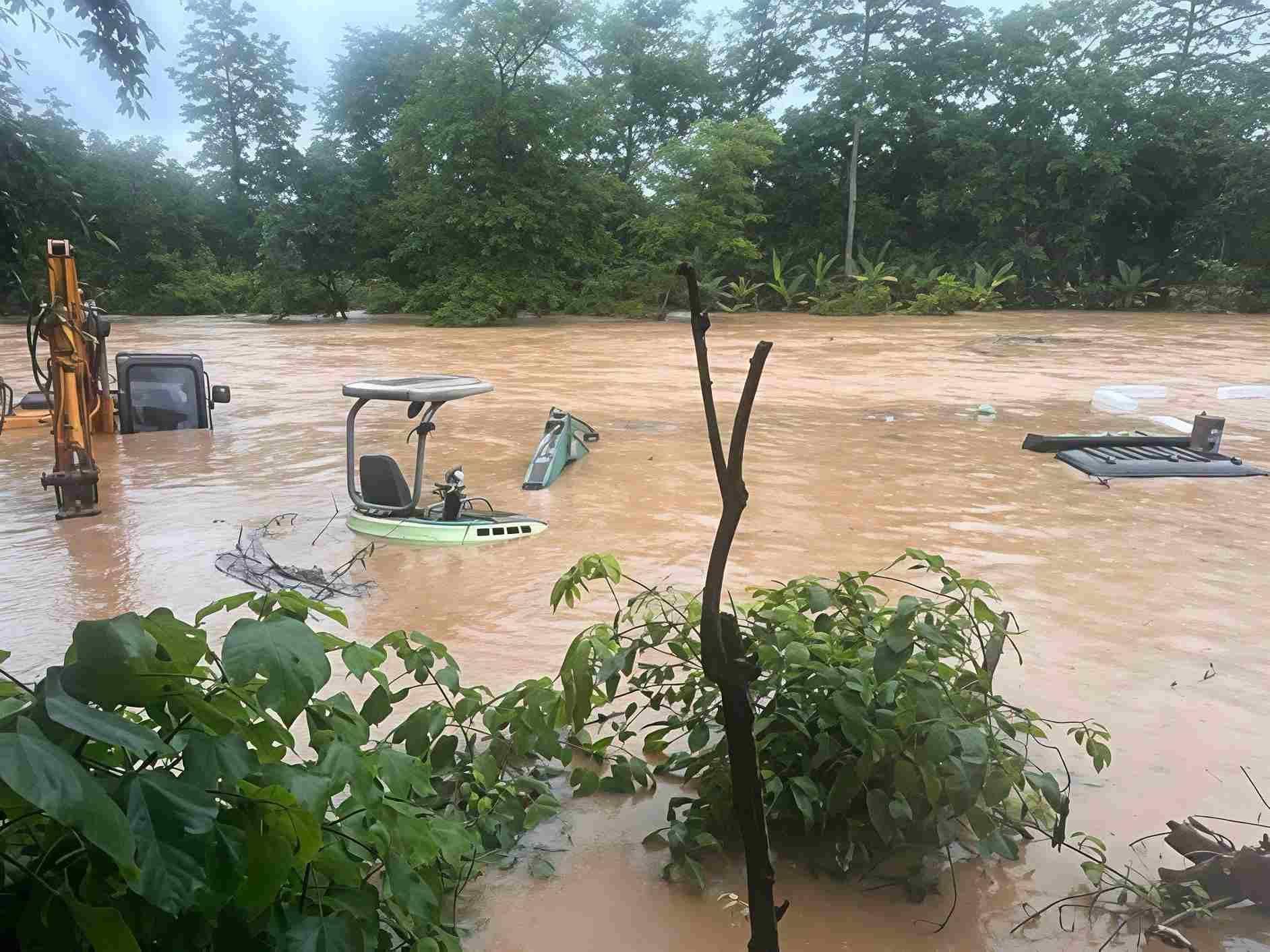
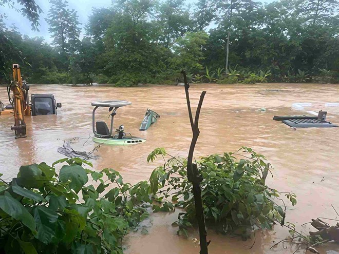
Nhiều phương tiện máy móc đã bị ngập sâu dưới dòng nước. Ảnh: Xã Hòa An

Both power plants stated that if heavy rain continues, the discharge rate may be increased and further announcements will be made.

Residents are advised to regularly monitor weather forecasts and disaster warnings, and to absolutely refrain from fishing, collecting firewood, or engaging in any activities in the riverbed or riverbanks during periods of heavy rain and flood discharge to ensure safety.


Tin liên quan

  • Lai Chau constructs emergency infrastructure to stabilize residents in disaster-stricken areas.
  • Dak Lak: First community flood shelter built in Hoa Thinh, a flood-prone area.
  • Unusually hot weather in Europe.
  • Dong Thap: Strong wind damage 37 houses.
  • Lao Cai proactively responds to extreme weather conditions.
  • Consolidation of Circular No. 13/2021/TT-BNNPTNT on Natural Disaster Prevention and Control Requirements
  • Advancing New Technologies in Natural Disaster Forecasting and Early Warning
  • Da Nang’s Civil Defense Mobilizes Combined Strength in Disaster Response
  • Death Toll in Ethiopia Landslides Rises to 125
  • Synchronizing Solutions for Flood and Landslide Control, Disaster Mitigation, and Early Warning Systems


  • Hệ thống giám sát thiên tai Việt Nam (VNDMS)

  • CSDL Quản lý rủi ro thiên tai dựa vào cộng đồng (Đề án 553)

  • CSDL Dân sinh kinh tế

  • CSDL Bản đồ sạt lở bờ sông, xói lở bờ biển

  • CSDL Không gian

  • CSDL Thư viện Chính sách và Kỹ thuật PCTT

  • CSDL Thiệt hại

  • CSDL Viễn thám

  • CSDL Khoa học công nghệ

  • Phần mềm hướng dẫn phổ biến kiến thức trực tuyến về PCTT

  • Trang Chuyển đổi số trong lĩnh vực Quản lý đê điều và Phòng, chống thiên tai

  • Phần mềm quản lý và giám sát camera

  • Phần mềm hỗ trợ xây dựng phương án ứng phó thiên tai

Thông tin thời tiết

Bản quyền © 2015 - Trung tâm Chính sách và Kỹ thuật phòng, chống thiên tai

Địa chỉ: Số 54 ngõ 102 Trường Chinh - Kim Liên - Hà Nội

Điện thoại: +84-436291511 - Fax: +84-437336647

Email: trungtamcsktpctt@gmail.com - Website: www.dmptc.gov.vn

Số người online: 218

Tổng số lượt truy cập: 116424