The U.S. Geological Survey said the magnitude of the earthquake was 7.0, after initially giving a preliminary magnitude of 6.7.
No tsunami danger exists for the U.S. west coast, British Columbia and Alaska, according to the US National Tsunami Warning Center. The center had initially issued a tsunami warning for coastal zones of southern Alaska.
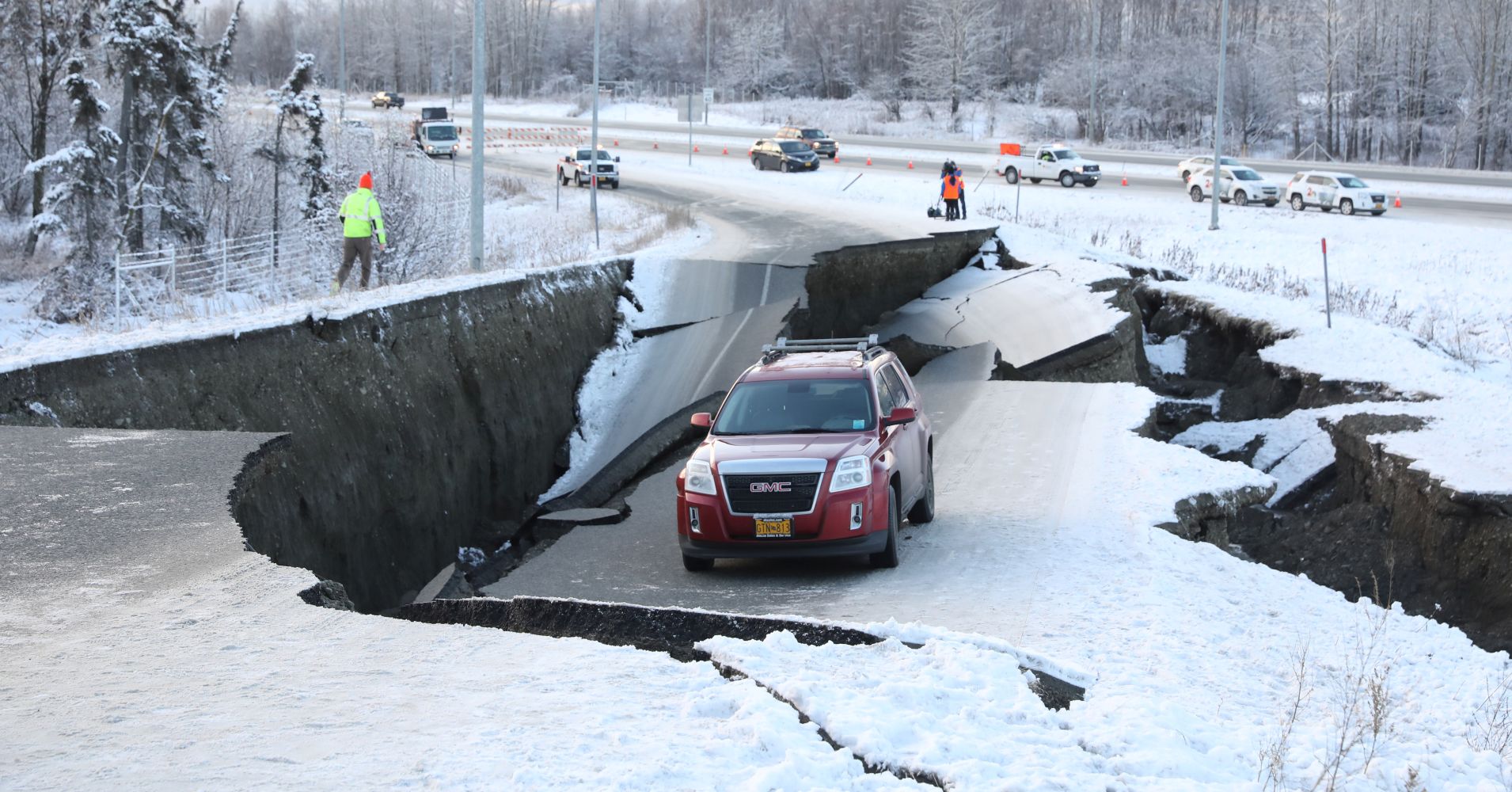
USGS says the earthquake Friday morning was centered about 7 miles (12 kilometers) north of Alaska's largest city, with a population of about 300,000. There were no immediate reports of any deaths or serious injuries.
All flights were halted at the airport after the quake knocked out telephones and forced the evacuation of the control tower, and the 800-mile Alaska oil pipeline was shut down while crews were sent to inspect it for damage. |

A vehicle lies stranded on a collapsed roadway near the airport after an earthquake in Anchorage, Alaska, U.S. November 30, 2018.
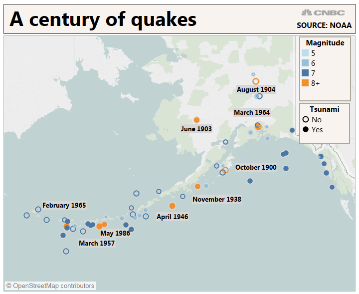
| Alaska averages 40,000 earthquakes per year, with more large quakes than the other 49 states combined.
Southern Alaska has a high risk of earthquakes due to tectonic plates sliding past each other under the region. According to the U.S. Geological Survey, the Pacific plate is sliding northwestward and plunges beneath the North American plate in southern Alaska, the Alaska Peninsula and the Aleutian Islands.
Alaska has been hit by a number of powerful quakes over 7.0 magnitude in recent decades, including a 7.9 that hit last January southeast of Kodiak Island. But it is rare for a quake this big to strike so close such a heavily populated area.
|

| On March 27, 1964, Alaska was hit by a magnitude 9.2 earthquake, the strongest recorded in U.S. history, centered about 75 miles (120 kilometers) east of Anchorage. The quake, which lasted about 4½ minutes, and the tsunami it triggered claimed about 130 lives. |