Trung tâm phòng tránh và giảm nhẹ thiên tai

Disaster Management Policyand Technology Center

Giao diện dễ tiếp cận vietnam english
Log in

Management - Cooperation - Work together

  • Homepage
  • About
    • About DMC
    • Organization Structure
    • Function & Tasks
    • Development stratery
  • News
    • National and International News
    • DMPTC News
  • Information Center
    • Disaster infomation
    • Basic knowledge
    • Library
      • Legal documents
      • Reference documents
      • IEC documents
      • CBDRM documents
        • Legal documents
        • Reference documents
        • IEC documents
    • CBDRM (Program 1002)
      • Project Matrix
      • Technical Assistance Network
      • CBDRM documents
        • Legal documents
        • Reference documents
        • IEC documents
      • Monitoring and Evaluation (M&E)
      • CBDRA
        • Disaster risks maps
        • CBDRA Reports
        • Other maps
      • Disaster prevention plans
    • Disaster risk maps
    • Irrigation systems
    • Trainings and Workshops
    • Gallery
  • Partners
  • Projects
  • DMC-Mail
  1. News
  2. Details
  • Share this on Facebook
  • Share this on Twitter
  • Share this on GooglePlus

The full moon tide in October, many roads in Ho Chi Minh City were flooded.

9:49:39, 28/11/2023 The high tide peaked during the full moon of the 10th lunar month, exceeding alert level 3, causing flooding in many places in Ho Chi Minh City, with water flooding across rivers and canals.

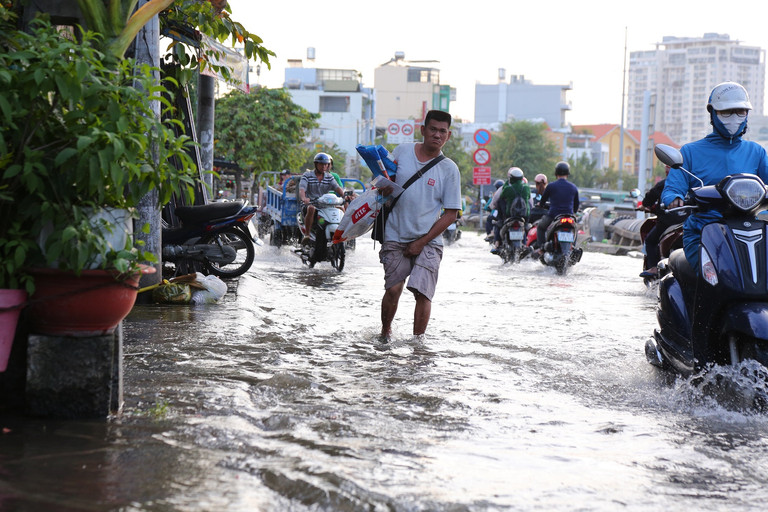
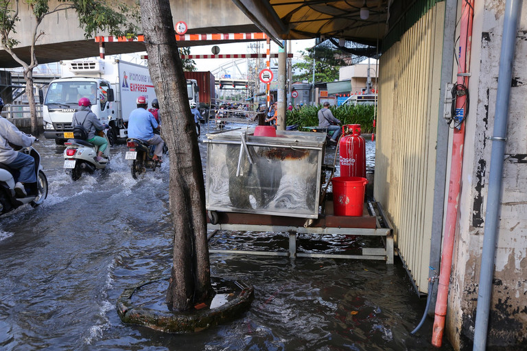
At 7:30 p.m. on November 27, many areas in the city. Ho Chi Minh City is still deeply flooded such as Tran Xuan Soan, Dao Su Tich, Huynh Tan Phat, Nguyen Binh, Le Van Luong, National Highway 50, Pham Huu Lau... making it very difficult for people to travel. On both sides of the road, business activities were "frozen", many families were hit by high tides, causing their lives to be turned upside down.
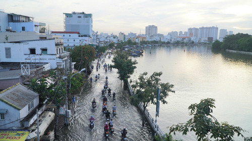
Previously, the Southern Regional Hydro-meteorological Station predicted that from November 27-29 (ie October 15-17 of the lunar calendar) there could be a peak tide exceeding alert level 3 according to the full moon tide period of the 10th lunar month. calendar.


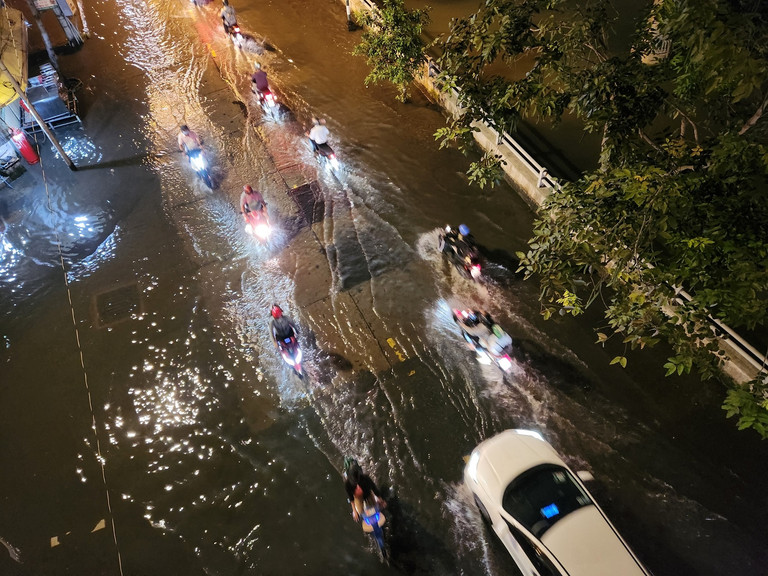
At 7:30 p.m., high tides flooded many low-lying areas in District 7 and Nha Be district of Ho Chi Minh City. Flooded water makes it difficult for people to know which road, river or canal is which.

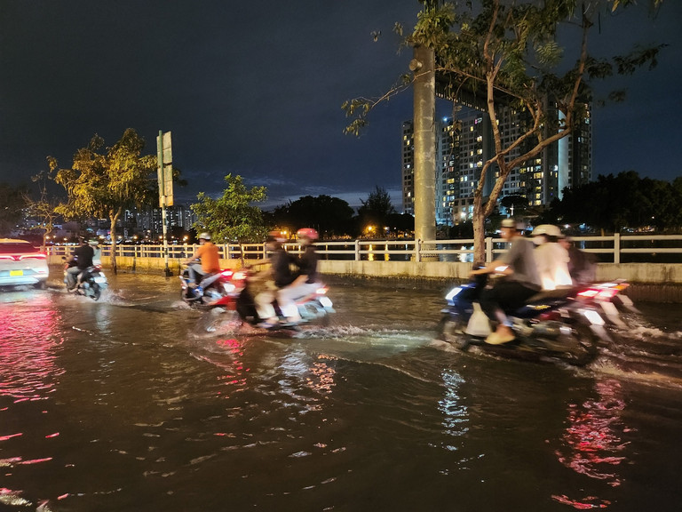
Tran Xuan Soan Street (District 7) is the road that is most frequently flooded during high tides. The flooding started at 4:30 p.m. but by 7:30 p.m., the water had not yet receded.


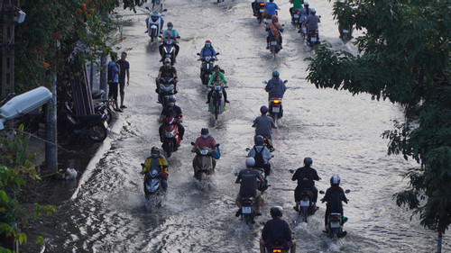
High tides cause flooding during off-work hours, making it very difficult for people to travel.

Mr. Vuong Quoc Khanh (61 years old) is pushing water away from his house and said: "Every high tide, this road is flooded, so we can't do any business, so we have to accept living together. Raising the house's foundation regularly is not good, because the tides are getting bigger every year, so there is no other way."


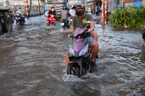
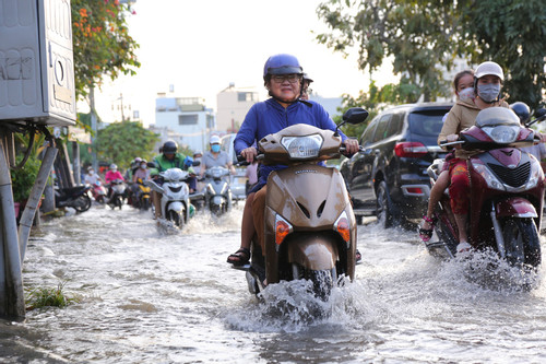
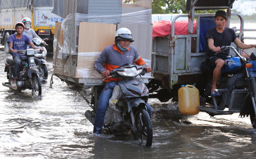
The water flooded like a river, making it difficult for people to travel.

Many people on Tran Xuan Soan street also fell into a situation where they could not move or stay. Business is also sluggish, having to wait for high tide to recede before opening to welcome customers.

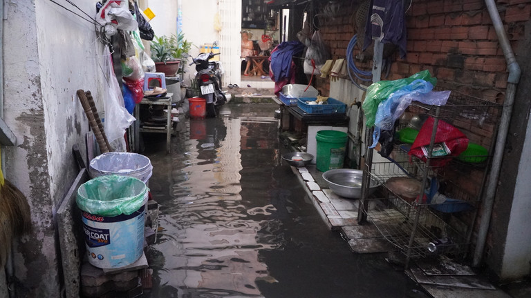
Every time a car passes by, water waves flood into the house. "This area often experiences flooding. "The water often rises a lot at night, this alley has been flooded for about half a month now," said Ms. Nguyen Thi Thanh Van (81 years old, District 7, Ho Chi Minh City)

Flooding caused many vehicle to stall.


Read more

  • Consolidation of Circular No. 13/2021/TT-BNNPTNT on Natural Disaster Prevention and Control Requirements
  • Advancing New Technologies in Natural Disaster Forecasting and Early Warning
  • Da Nang’s Civil Defense Mobilizes Combined Strength in Disaster Response
  • Death Toll in Ethiopia Landslides Rises to 125
  • Synchronizing Solutions for Flood and Landslide Control, Disaster Mitigation, and Early Warning Systems
  • Ho Chi Minh City: Criteria for ensuring natural disaster prevention and control in the use of construction works and housing
  • Northern Vietnam to see rain end from March 17 as sunny weather returns
  • Quang Tri: Addressing Coastal Embankment Erosion Near Vinh Moc Tunnels
  • Dyke Safety Prioritized from the Start of the Year
  • Science and Technology Must Be the "Lever" for the Water Sector’s Transformation


  • Vietnam Natural Disaster Monitoring System (VNDMS)

  • Community-Based Disaster Risk Management Database (Project 553)

  • Socio-economic database

  • Riverbank landslides, coastal erosion database

  • Spatial for disaster management database

  • Library Disaster Management Policy and and Technology Center

  • Damage database

  • Satellite database

  • Science and Technology Database

  • Online Knowledge Dissemination Software for Disaster Prevention

  • Digital transformation portal in disaster management

  • Camera Management and Monitoring Software

Weather forecast

Copyright © 2015 - Trung tâm Chính sách và Kỹ thuật phòng, chống thiên tai

Address: Số 54 ngõ 102 Trường Chinh - Kim Liên - Hà Nội

Phone: +84-436291511 - Fax: +84-437336647

Email: trungtamcsktpctt@gmail.com - Website: www.dmptc.gov.vn

Online users: 459

Visistors: 85770