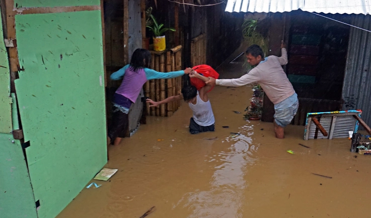
Heavy rain caused house flooded in Surigao del Sur, island Mindanao, Philippines on 21-2
On the afternoon of February 22, typhoon Dujuan was operating in the southeastern Philippines sea and weakened into a tropical depression. According to the National Center for Hydrometeorological Forecasting, the tropical low pressure center on the afternoon of February 22 is right on the southeast coast of the Philippines. The strongest wind in the area near the center of tropical low pressure reaches level 6-7 (40-60km / h), level 9.
It is forecasted that tropical depression will move in the northwest direction, travel 15-20km per hour and weaken into a low pressure area. At 7:00 am on February 23, the center of the low pressure region in the central region of the Philippines. The strongest wind in the center of the low pressure area falls below level 6 (below 40km / h).
From 7:00 am on February 23 to 7:00 a.m. on February 24, the low pressure area moved in a northwest direction, into the South China Sea, then further weakened.
The National Center for Meteorological and Hydrological Forecasting that Typhoon Dujuan has weakened into a tropical depression, so it has no impact on the mainland of our country, but the impact of low pressure is likely to cause strong winds of 7-8. on the sea. Thunderstorms strongly appear in the western part, which can jeopardize vessels operating in the southeast sea of the South China Sea.
To proactively respond to changes in strong winds, high waves and typhoons Dujuan, the Central Steering Committee for natural disaster prevention sends documents to coastal provinces and cities from Quang Ninh to Ca Mau regarding the response. with typhoon Dujuan being active near the South China Sea.
In addition, this time is the season for fishing, the number of ships and boats operating on the sea is large. Therefore, the Steering Committee for natural disaster prevention and search and rescue in coastal provinces and cities needs to closely monitor, inform owners and captains of ships and boats about the situation of strong winds and high waves. sea and storm Dujuan to take initiative in preventive measures, ensure the safety of people and means as well as the appropriate production plans.
The Steering Committee also requires relevant functional forces of localities to maintain communications in order to promptly handle possible bad situations; to be ready for rescue and rescue forces and means in order to promptly deploy the rescue when required.