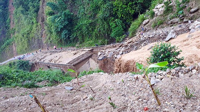
According to the National Center for Hydrometeorological Forecasting information, in the past 2 weeks, Chinese territory has appeared heavy rains and historic floods, especially in the Truong Giang river basin.
The actual rainfall measured at international meteorological stations in June 2020 in some provinces in China was popular as follows: Hubei province from 300-400m; Chongqing, Guizhou, Guangxi from 200-400mm; Guilin station in Guangxi reached over 600mm.
The cause of heavy rains in the past 2 weeks in the East and Southeast areas of China was due to the impact of a strip of Front clouds; called Front Mei-yu has been studied by many Chinese and Japanese scientists, which is responsible for the heavy rainfall and flooding in South China and Taiwan (China) in May, June and Japan in June and July. However, Front Mei-yu has little impact on the northern region of Vietnam.

The situation of rain and flood is expected to be complicated in the coming time
Meanwhile, assessing the situation of rainstorm in Vietnam in the last 6 months of the year, the National Center for Hydrometeorological Forecasting said that for the Northern region during the rainy season, the focus is on the period from August to mid-October. There are about 1-2 tropical cyclones and storms affecting the Northern region from August to October 2020.
Regarding rainfall, in July 2020, it is common that there is a shortage of about 10-25%; August, October and November 2020 are at approximately the average of many years (AMC); September is 15-30% higher than AMC, compared to the Northern Delta region, which is approximately the same as the average. In December 2020, the prevalence was 15-30% lower than that of AMC
During the first half of July, there will be small floods on the upper part of the Red-Thai Binh river system with a flood amplitude of 2-4m.
Flood peaks in the rivers can reach level 1, small rivers and streams level 2. The highest flood peak on rivers and streams from the end of July-October 2020 is popular at level 1-2, higher than 2019, as follows: and the Hoang Long River from level 2-3 ; Da and upstream Thai Binh rivers at level 1-2; flood downstream Lo River is at level 1; downstream of Red River in Hanoi and Thai Binh downstream at Pha Lai below the level 1
Floods on small streams and rivers belonging to Red-Thai Binh river system are at level 3 and above level 3. Flash floods, landslides are at high risk in mountainous areas, especially in the Northwest.
According to the general opinion, the monthly rainfall tends to be approximately and lower than the AMY, however, the actual data show that heavy rain in a short time has caused large and extremely large floods.
With the current abnormal weather events and the situation of rain and floods happening in the southern provinces of China, the complexity of this year's rainy season in the Northern region in particular and the whole country in general. The risk of large flood occurrence is always potential.
Particularly in the North, from now, July 1 to July 4, there will be thunderstorms, mountainous provinces need to prevent whirlwinds, flash floods, landslides. The heat also retreated in this area.