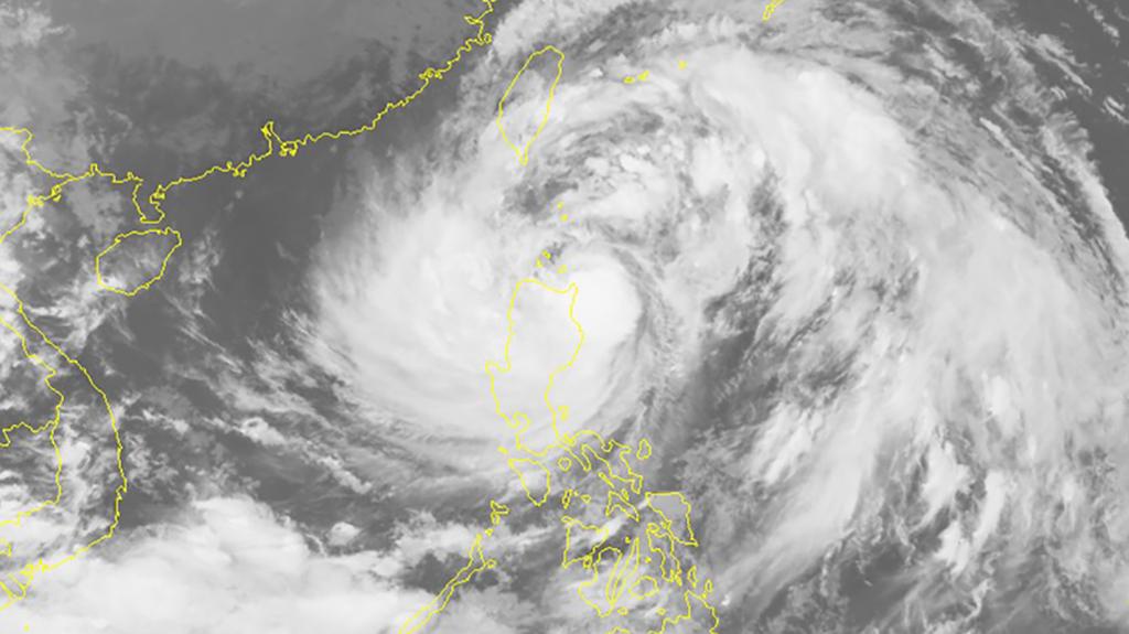
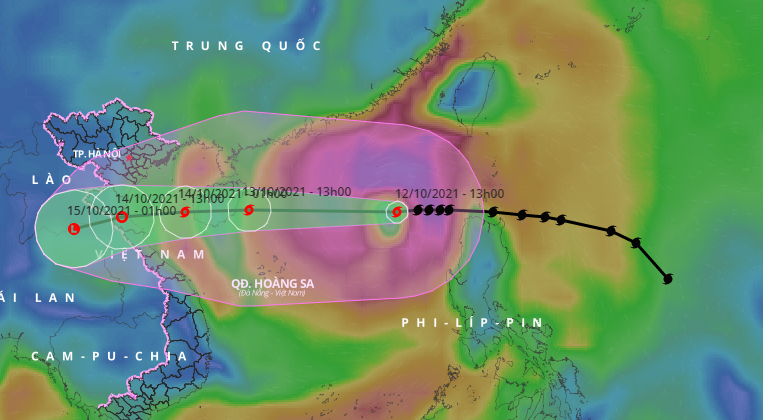
According to the National Center for Hydrometeorological Forecasting, in the first half of October, the East Sea continuously appeared tropical depressions, then strengthened into storms. In addition to the new storm No. 8 entering the East Sea this morning, storms No. 6 and No. 7 in the East Sea previously caused heavy rain to the mainland provinces of the North and North Central.
So, why in a short time, the East Sea has continuously had storms and tropical depressions like the past?
Explaining this weather development, Mr. Nguyen Van Huong, Head of Climate Forecasting Department, National Center for Hydro-meteorological Forecasting, said that according to statistics so far, about 70% of tropical depressions have Storms form on the tropical convergence band.
Currently, in the East Sea, there is a tropical convergence band with an axis crossing the northern provinces and it is this tropical convergence band that is the cradle of tropical cyclones to continue to strengthen into a low pressure. , storms like in the past.
As a rule in many previous rainy and stormy seasons, October is always the month when storms and tropical depressions appear with the most frequency.

Storm No. 8 has a very wide circulation, causing heavy rain from the south of the northern delta to the north and central central provinces.
National Hydrometeorological Forecasting Center
Also according to Mr. Nguyen Van Huong, currently storm No. 8 is active in the East Sea and is forecast to directly affect the North Central region from the afternoon of October 13 to October 14. Immediately after storm No. 8, the East Sea continues to produce another tropical depression and this tropical depression may strengthen into a storm. If this scenario happens, the East Sea will receive the 4th storm in October this year.
Storm No. 8 moves fast, forecast to cause heavy rain in the North and Central region

Storm No. 8 moves fast, forecast to cause heavy rain in the North and Central region
Storm circulation forecast No. 8 will cause heavy rain in the northern and central central provinces from October 13 to 15. Immediately after that, the cold air that is directly affecting the Northern provinces will have a resonance with the tropical convergence band across the Central region, causing this area to continue to have heavy rain on a large scale lasting until about the 19th. - 20.10.
Cold air continues to affect with the tropical convergence band to maintain large-scale thunderstorms in the central provinces from October 15 to around October 19 - 20.
Due to the continuous influence of storms and tropical depressions on the East Sea, the total rainfall in October, November and December in the Central region of this year will be 30-50% higher than the average rainfall in this year. many years”, Mr. Huong said.