Trung tâm phòng tránh và giảm nhẹ thiên tai

Disaster Management Policyand Technology Center

Giao diện dễ tiếp cận vietnam english
Log in

Management - Cooperation - Work together

  • Homepage
  • About
    • About DMC
    • Organization Structure
    • Function & Tasks
    • Development stratery
  • News
    • National and International News
    • DMPTC News
  • Information Center
    • Disaster infomation
    • Basic knowledge
    • Library
      • Legal documents
      • Reference documents
      • IEC documents
      • CBDRM documents
        • Legal documents
        • Reference documents
        • IEC documents
    • CBDRM (Program 1002)
      • Project Matrix
      • Technical Assistance Network
      • CBDRM documents
        • Legal documents
        • Reference documents
        • IEC documents
      • Monitoring and Evaluation (M&E)
      • CBDRA
        • Disaster risks maps
        • CBDRA Reports
        • Other maps
      • Disaster prevention plans
    • Disaster risk maps
    • Irrigation systems
    • Trainings and Workshops
    • Gallery
  • Partners
  • Projects
  • DMC-Mail
  1. News
  2. Details
  • Share this on Facebook
  • Share this on Twitter
  • Share this on GooglePlus

Quang Ngai records over 90 landslide sites along roads

10:2:13, 20/11/2026 Heavy, prolonged rainfall from November 9 to 12 caused damage to housing, transport infrastructure, irrigation systems, and agricultural production in many localities.

Quảng Ngãi ghi nhận hơn 90 điểm sạt lở trên các tuyến đường
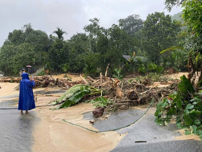
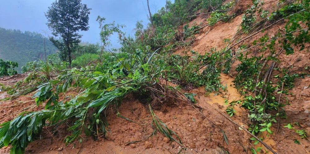
Landslides have caused severe damage to many roads in Thanh Bong Commune, Quang Ngai Province.

On November 13, the Irrigation Sub-department of Quang Ngai Province reported that heavy rainfall across the province over the past few days (from November 9 to 12) has caused damage to transport and irrigation infrastructure in many localities.

According to preliminary statistics, one house in the province has collapsed, 39 houses have sustained damage or lost their roofs, and 106 houses have been affected by flooding. More than 90 locations along roads managed by the Department of Construction have experienced landslides. Additionally, approximately 62 commune-level roads have suffered landslides or damage at various points. Among these, Son Tay Ha Commune has the highest number of affected roads, with 10, followed by Son Tay Commune with 6, and Son Mai Commune with 5.
Nhiều tuyến đường ở miền núi Quảng Ngãi chìm trong bùn đất do mưa lớn kéo dài. Ảnh: Trọng Quốc
Many roads in the mountainous region of Quang Ngai are submerged in mud due to prolonged heavy rain. 

The Vinh Phuoc embankment project in Son Tinh Commune has suffered landslides and subsidence along a stretch of approximately 350 meters, while the anti-erosion embankment along the Hy Long stream in Ba Vinh Commune has experienced landslides spanning 180 meters. About 14 diversion dam structures have become silted up at their headworks. Furthermore, numerous irrigation canals and rural clean water supply systems in the mountainous region have sustained damage.

Prolonged heavy rainfall over the past few days has also damaged 1 hectare of crops in Binh Son Commune. Additionally, more than 30 hectares of land used for rice and other crops across the communes of Binh Son and Dinh Cuong have been affected.

At present, relevant authorities and local governments are focusing on addressing the aftermath of the heavy rains. Many localities have yet to complete their damage assessments, as some areas remain flooded or affected by landslides.


(Source: Lao Dong Newspaper)

Read more

  • Dak Lak proactively responds to drought caused by El Niño
  • Quang Tri: Floating houses and digital technology help residents cope with natural disasters.
  • El Niño could reach very strong intensity: Heavy rain and cold air with unpredictable patterns.
  • Lao Cai issues urgent support rates for residents forced to evacuate disaster-stricken areas.
  • Lai Chau constructs emergency infrastructure to stabilize residents in disaster-stricken areas.
  • Cao Bang: The first rains of the season cause flooding and landslides in many areas.
  • Dak Lak: First community flood shelter built in Hoa Thinh, a flood-prone area.
  • Unusually hot weather in Europe.
  • Dong Thap: Strong wind damage 37 houses.
  • Lao Cai proactively responds to extreme weather conditions.


  • Vietnam Natural Disaster Monitoring System (VNDMS)

  • Community-Based Disaster Risk Management Database (Project 553)

  • Socio-economic database

  • Riverbank landslides, coastal erosion database

  • Spatial for disaster management database

  • Library Disaster Management Policy and and Technology Center

  • Damage database

  • Satellite database

  • Science and Technology Database

  • Online Knowledge Dissemination Software for Disaster Prevention

  • Digital transformation portal in disaster management

  • Camera Management and Monitoring Software

Weather forecast

Copyright © 2015 - Trung tâm Chính sách và Kỹ thuật phòng, chống thiên tai

Address: Số 54 ngõ 102 Trường Chinh - Kim Liên - Hà Nội

Phone: +84-436291511 - Fax: +84-437336647

Email: trungtamcsktpctt@gmail.com - Website: www.dmptc.gov.vn

Online users: 2037

Visistors: 142027