| Its center was about 100km east-southeast of Phan Rang City in the central province of Ninh Thuan and about 200km to the east-northeast of La Gi Town in the central province of Binh Thuan, carrying maximum wind speed of 60km/h.
The depression would move westward at 10km/h and is expected to reach Vietnam’s coast from Binh Thuan Province to the southern province of Ba Ria-Vung Tau at around 4 p.m. today, weather stations said.
|

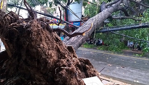
A street scene in the Mekong Delta province of Can Tho after a rainstorm Saturday afternoon. Photo by VnExpress/Hung Loi
|
It is also likely to further devolve into a normal depression as it moves west-southwest later, with wind speeds between 10-15km/h.
Toraji, as the storm was internationally named, was spotted Saturday night at around 240km (149 miles) east of the coast of Ninh Thuan and Binh Thuan with wind speeds of up to 75km/h.
Weather experts said southern, south central coastal provinces and the southern part of Central Highlands should expect heavy rainfall of up to 150 millimeters from Saturday night until Monday.
Le Dinh Quyet, a meteorologist from the Southern Hydrometeorological Center, said it is likely that Ba Ria-Vung Tau, around 90 kilometers to the southeast of HCMC, will be directly affected by the depression.
Vietnam was struck by a record-breaking number of 16 tropical storms in 2017 that left 389 people dead or missing and injured 668 others, mostly in northern and central regions.
The General Statistics Office estimated damage at around VND60 trillion ($2.64 billion), 1.5 times the previous year’s figure.
|