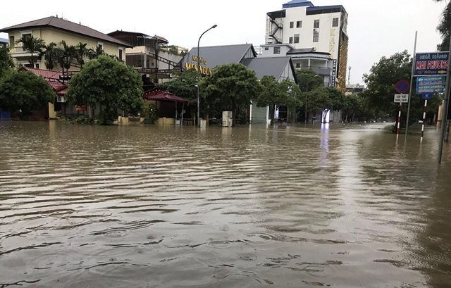
Heavy rain causes flood in Thái Nguyên Province.
Its aim is to share knowledge and expertise with policy makers, universities, research institutions and international development partners, industry and private partners on issues relating to natural disasters.
Nguyễn Quốc Phi, from Hà Nội University of Mining and Geology, said the study conducted by him and his students showed landslides are frequent in the North and North Central Provinces.
From 2010 to 2016, at least 577 lives were lost due to landslides. As well as loss of lives and structural damage, landslides damaged agricultural land and roads, causing economic disruption.
Phi said the community had most to gain if they can reduce the impact of disasters by effectively using their capacities.
Matthieu Kervyn, from the Free University of Brussels in Belgium, agreed, saying a scarcity of reliable data had hampered effective disaster risk reduction.
That was the reason why the Brussels cooperated with Vietnamese partners in developing a network of geo-observers.
The geo-observer network has been piloted in Uganda. It demonstrated that local people are valuable assets in collecting data on their environment through knowledge on their environment and direct access to the field.
“The establishment of a geo-observer network in Việt Nam will be objective to decision-making of local authorities,” he told Việt Nam News.
"The involvement of local stakeholders during the data collection period makes the database more complete.”
He also said a pilot project would be implemented soon to build capacity for disaster management for the mountainous region of Hòa Bình Province’s Đà Bắc District which is considered a hot spot of landslide. Analysis of climate change impact, consideration of increased risk and vulnerability as well as actions for capacity building, awareness raising and infrastructure works were all topics on the table.
Regarding technology solutions, Lê Quang Tuấn, deputy director of the Department of Science Technology and International Cooperation under Việt Nam Disaster Management Authority, said the application of new technology would be a big help.
Fly cams are currently used to monitor, survey and access areas affected by natural disasters. It is transmitting detailed images for data.
“In cases of serious flooding like the one in Hà Nội’s Chương Mỹ District in April last year, using mobile dykes will not only prevent overflow but help save human resources and time,” he said.
The mobile dyke, which was produced by Tân Đại Hưng Joint Stock Company in collaboration with AquaDam Inc from the US, has been tested in Nam Định Province recently and proved to be effective.
“The department has been developing an app to let people know if they are in a dangerous area,” he said.
Tuấn said challenges the department faced included limitations in protecting coastal banks in the Mekong Delta due to lack of sand and water and there is no mechanism for mobilisation of the private sector in the application of new science and technology.
The lack of equipment and lack of investment to synchronise specialised monitoring and warning systems were also a problem, he said.
The workshop was organised by the Belgium Embassy in close collaboration with Việt Nam Institute of Geosciences and Mineral Resources (VIGMR) and Free University of Brussels.